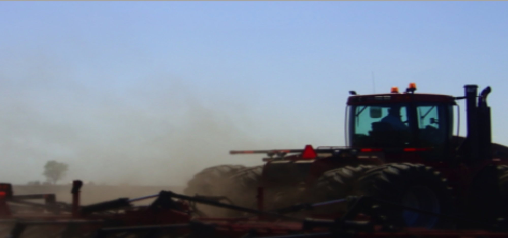

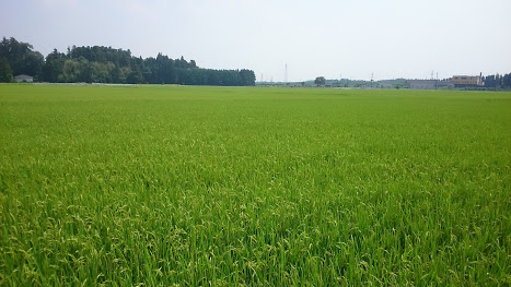
Agricultural remote sensing and decision support system have been employed to bring the solution in site-specific management of crop production in the regional scales. The crops phonology indices shows the signatures effect in the water stress, plant growth and yield estimations. Our team is focusing the regional scales of remote sensing application using satellite datasets from Landsat 8, Sentinel II, MODIS imagery, and JAXA worldwide rainfall measurement platform. We have been using JAXA satellite rainfall information for forecasting and downscaling precipitation information in the macro levels of regional scales. At the same time, land surface temperature information are taken to model crop growth at the different stages. Land use and land change (LULC), land suitability assessments for crop production are developed to introduce a new concept of the geospatial insurance system to help farmers using satellite remote sensing, GIS and machine learning concepts. The Vegetation Indices and Weather-based Insurance for crop production are in lined with damaged-based insurances during crop growths.
Peer Reviewed Research Articles:
- Senevirathne, N.S.L. & Ahamed, T. (2024). Rapid Analysis of Soil Organic Carbon in Agricultural Lands: Potential of Integrated Image Processing and Infrared Spectroscopy. AgriEngineering, 6, 3001-3015. https://doi.org/10.3390/agriengineering6030172
- Htun, A. M., Shamsuzzoha, M., & Ahamed, T. (2023). Rice yield prediction model using normalized vegetation and water indices from Sentinel-2A satellite imagery datasets. Asia-Pacific Journal of Regional Science, 1-29.DOI: 10.1007/s41685-023-00299-2
- Alam, K. F., & Ahamed, T. (2023). Climate-Adaptive Potential Crops Selection in Vulnerable Agricultural Lands Adjacent to the Jamuna River Basin of Bangladesh Using Remote Sensing and a Fuzzy Expert System. Remote Sensing, 15(8), 2201.DOI: 10.3390/rs15082201
- Islam, M. M., & Ahamed, T. (2023). Development of a near-infrared band derived water indices algorithm for rapid flash flood inundation mapping from sentinel-2 remote sensing datasets. Asia-Pacific Journal of Regional Science, 1-26.DOI: 10.1007/s41685-023-00288-5
- Alam, K. F., & Ahamed, T. (2023). Erosion vulnerable area assessment of Jamuna River system in Bangladesh using a multi-criteria-based geospatial fuzzy expert system and remote sensing. Asia-Pacific Journal of Regional Science, 7(2), 433-454.DOI: 10.1007/s41685-023-00292-9
- Arab, S. T., & Ahamed, T. (2023). Near-real-time drought monitoring and assessment for vineyard production on a regional scale with standard precipitation and vegetation indices using Landsat and CHIRPS datasets. Asia-Pacific Journal of Regional Science, 7(2), 591-614.DOI: 10.1007/s41685-023-00286-7
- Shamsuzzoha, M., & Ahamed, T. (2023). Shoreline Change Assessment in the Coastal Region of Bangladesh Delta Using Tasseled Cap Transformation from Satellite Remote Sensing Dataset. Remote Sensing, 15(2), 295.DOI: 10.3390/rs15020295
- Alam, K. F., & Ahamed, T. (2022). Assessment of Land Use Land Cover Changes for Predicting Vulnerable Agricultural Lands in River Basins of Bangladesh Using Remote Sensing and a Fuzzy Expert System. Remote Sensing, 14(21), 5582.DOI: 10.3390/rs14215582
- Sara Tokhi Arab and Tofael Ahamed. Land Suitability Analysis for Potential Vineyards Extension in Afghanistan at Regional Scale Using Remote Sensing Datasets. Remote Sensing, 14(18), 4450. https://doi.org/10.3390/rs14184450. 2022
- Md Shamsuzzoha, Ryozo Noguchi, Tofael Ahamed, Rice Yield Loss Area Assessment from Satellite-derived NDVI after Extreme Climatic Events Using a Fuzzy Approach, Agricultural Information Research, 31(1):32-46, https://doi.org/10.3173/air.31.32 2022.
- Sara Tokhi Arab, Ryozo Noguchi and Tofael Ahamed. Yield loss assessment of grapes using composite drought index derived from Landsat OLI and TIRS datasets. Remote Sensing Applications: Society and Environment, 26, 100727, https://doi.org/10.1016/j.rsase.2022.100727
- Islam, Md Monirul, Kiyokazu Ujiie, Ryozo Noguchi, and Tofael Ahamed. Flash flood-induced vulnerability and need assessment of wetlands using remote sensing, GIS, and econometric models. Remote Sensing Applications: Society and Environment (2022): 100692. DOI:1016/j.rsase.2021.100692
- Islam, M., Matsushita, S., Noguchi, R., & Ahamed, T. (2022). A damage-based crop insurance system for flash flooding: a satellite remote sensing and econometric approach. Asia-Pacific Journal of Regional Science, 6(1), 47-89. DOI:1007/s41685-021-00220-9
- Das AC, Noguchi R, Ahamed T. An Assessment of Drought Stress in Tea Estates Using Optical and Thermal Remote Sensing. Remote Sensing. 2021; 13(14):2730. https://doi.org/10.3390/rs13142730
- Rubaya Binte Mostafiz, Ryozo Noguchi, Tofael Ahamed. Agricultural Land Suitability Assessment Using Satellite Remote Sensing-Derived Soil-Vegetation Indices. Land 10(2):223. https://doi.org/10.3390/land10020223, 2021
- Rubaya Binte Mostafiz, Ryozo Noguchi, Tofael Ahamed. Calorie-based Seasonal Multicrop Land Suitability Analysis for Regional Food Nutrition Security in Bangladesh. Asia-Pacific Journal of Regional Science, https://doi.org/10.1007/s41685-021-00197-5, 2021
- Shamsuzzoha, Md, Ryozo Noguchi, and Tofael Ahamed. “Damaged area assessment of cultivated agricultural lands affected by cyclone bulbul in coastal region of Bangladesh using Landsat 8 OLI and TIRS datasets.” Remote Sensing Applications: Society and Environment23 (2021): 100523. https://doi.org/10.1016/j.rsase.2021.100523
- Sara Tokhi Arab, Ryozo Noguchi, Shusuke Matsushita, Tofael Ahamed. Prediction of grape yields from time-series vegetation indices using satellite remote sensing and a machine-learning approach. Remote Sensing Applications: Society and Environment Volume 22, April 2021, 100485. https://doi.org/10.1016/j.rsase.2021.100485
- Animesh Chandra Das ,Ryozo Noguchi and Tofael Ahamed. Integrating an Expert System, GIS, and Satellite Remote Sensing to Evaluate Land Suitability for Sustainable Tea Production in Bangladesh. Remote Sens. 2020, 12(24), 4136; https://doi.org/10.3390/rs12244136
- Md. Monirul Islam, Shusuke Matsushita, Ryozo Noguchi, Tofael Ahamed. Development of remote sensing-based yield prediction models at the maturity stage of boro rice using parametric and nonparametric approaches. Remote Sensing Applications: Society and Environment Volume 22, April 2021, 100494. https://doi.org/10.1016/j.rsase.2021.100494
- Muhammad Iqbal Habibie, Ryozo Noguchi, Shusuke Matsushita, Tofael Ahamed. Development of micro-level classifiers from land suitability analysis for drought-prone areas in Indonesia. Remote Sensing Applications: Society and Environment. Volume 20, November 2020, 100421. https://doi.org/10.1016/j.rsase.2020.100421
- Tofael Ahamed, Ryozo Noguchi, Nazia Muhsin, Riska Ayu Purnamasari, Md. Ariful Islam, Farhat Tasnim, Md. Zamirul Islam, Md. Fakrul Islam, Wardatul Akmam. Sustainable agricultural development: a micro-level GIS- based study on women’s perceptions of environmental protection and entrepreneurship in Japan and Bangladesh, GeoJournal, https://doi.org/10.1007/s10708-020-10169-5, 2020.
- Muhammad Iqbal Habibie, Ryozo Noguchi, Matsushita Shusuke, Tofael Ahamed. Development of micro-level classifiers from land suitability analysis for drought-prone areas in Indonesia, Remote Sensing Applications: Society and Environment, 20, 100421. 2020. https://doi.org/10.1016/j.rsase.2020.100421
- Nurda, Nety, Noguchi, Ryozo. & Ahamed, T. Change Detection and Land Suitability Analysis for Extension of Potential Forest Areas in Indonesia Using Satellite Remote Sensing and GIS. Forests 2020, 11(4), 398. 02 Apr 2020. https://doi.org/10.3390/f11040398
- Nurda, Nety, Noguchi, Ryozo. & Ahamed, T. Forest productivity and carbon stock analysis from vegetation phenological indices using satellite remote sensing in Indonesia. Asia-Pac J Reg Sci (2020). https://doi.org/10.1007/s41685-020-00163-7.
- Muhammad Iqbal Habibie, Ryozo Noguchi, Shusuke Matsushita, Tofael Ahamed. Land suitability analysis for maize production in Indonesia using satellite remote sensing and GIS-based multicriteria decision support system. GeoJournal (2019). https://doi.org/10.1007/s10708-019-10091-5
- Muhammad Ansori Nasution, Ayu Wulandari, Tofael Ahamed, Noguchi Ryozo. Alternative POME Treatment Technology in the Implementation of Roundtable on Sustainable Palm Oil, Indonesian Sustainable Palm Oil (ISPO), and Malaysian Sustainable Palm Oil (MSPO) Standards Using LCA and AHP Methods, Journal of Material Cycles and Waste Management, Sustainability 2020, 12(10), 4101; https://doi.org/10.3390/su12104101
- Islam, Md. Monjurul; Ahamed, Tofael; Noguchi, Ryozo. (2018). “Land Suitability and Insurance Premiums: A GIS-based Multicriteria Analysis Approach for Sustainable Rice Production.” Sustainability, 10(6); 1759, 1-28, doi: DOI: 10.3390/su10061759
- Riska Ayu Purnamasari, Ryozo Noguchi, Tofael Ahamed. Land Suitability Assessment for Yield Prediction of Cassava using Geospatial Fuzzy Expert Systems and Remote Sensing, Computer and Electronics in Agriculture, 166, https://doi.org/10.1016/j.compag.2019.105018 2019.
- Riska Ayu Purnamasari, Tofael Ahamed, Ryozo Noguchi. Land Suitability Assessment for Cassava Production in Indonesia Using GIS, Remote Sensing and Multi-Criteria Analysis, Asia-Pacific Journal of Regional Science, 2019(3)1-32, doi: https://doi.org/10.1007/s41685-018-0079-z
- Muhsin, Nazia., Tofael Ahamed and Ryozo Noguchi. GIS-based multi-criteria analysis modeling used to locate suitable sites for industries in suburban areas in Bangladesh to ensure the sustainability of agricultural lands, Asia-Pacific Journal of Regional Sciences, 2(1):35-64 Springer, 2017.4, doi: http://link.springer.com/10.1007/s41685-017-0046-0
- Afsana Akther, Tofael Ahamed, Ryozo Noguchi, Genkawa Takuma and Tomohiro Takigawa. Site Suitability Analysis of Biogas Digester Plant for Municipal Waste Using GIS and Multi-Criteria Analysis, Asia Pacific Journal of Regional Sciences, 2019(3):61-93, https://doi: 10.1007/s41685-018-0084-2
- Nugroho Adi Sasongko, Ryozo Noguchi, Tofael Ahamed, Environmental load assessment for an integrated design of microalgae system of palm oil mill in Indonesia, Energy, 2018, https://doi.org/10.1016/j.energy.2018.03.144
- Afsana Akther, Tofael Ahamed, Tomohiro Takigawa, Ryozo Noguchi GIS-based Multi-criteria Analysis for Urban Waste Management, Journal of the Japan Institute of Energy, 95:457-467, 2016. doi:10.3775/jie.95.457
- Nasution, Muhammad Ansori, Dhani S. Wibawa, Tofael Ahamed, and Ryozo Noguchi. Comparative environmental impact evaluation of palm oil mill effluent treatment using a life cycle assessment approach: A case study based on composting and a combination for biogas technologies in North Sumatera of Indonesia, Journal of Cleaner Production, 2018. https://doi.org/10.1016/j.jclepro.2018.02.299
- Wibawa Sujono Dhani Satria, Muhammad Ansori Nasution, Noguchi Ryozo, Tofael Ahamed, Mikihide Demura, Makoto M. Watanabe. Microalgae Oil Production: A Downstream Approach to Energy Requirements for the Minamisoma Pilot Plant, Energies, 11(3), 521, 2018. doi :10.3390/en11030521
- Muhammad Ansori Nasution, Wibawa Sujono Dhani Satria, Tofael Ahamed, Noguchi Ryozo. Selection of Palm Oil Mill Effluent Treatment for Biogas Generation or Compost Production Using an Analytic Hierarchy Process, Journal of Material Cycles and Waste Management, Springer-Nature, 2017. doi: 10.1007/s10163-017-0638-9
- Nugroho Adi Sasongko, Ryozo Noguchi, Tofael Ahamed, Tomohiro Takigawa. Introduction of Integrated Energy Plantation Model for Microalgae-Using Palm Oil Mill Effluent (POME), Journal of Japan Institute of Energy 94, 561-570, 2015. doi: 10.3775/jie.94.561
- Sasiwimol Khawkomol, Eriko Ankyu, Ryozo Noguchi, Tofael Ahamed. Evaluation of Biofuel Production Using Energy and Exergy Analyses- Introduction of a System Design Concept for Achieving Final Benefits, Agricultural Information Research, Japanese Society of Agricultural Informatics, 22 (2), 132-141, 2013.12. Sasiwimol Khawkomol, Ryozo Noguchi. doi: https://doi.org/10.3173/air.22.132
- Tofael Ahamed, Takuma Genkawa and Tomohiro Takigawa, ANP Modeling to Select biomass Energy Plant in Rural Areas of Thailand, Agricultural Information Research, Japanese Society of Agricultural Informatics, 22 (2), 117-131, 2013.13. doi: https://doi.org/10.3173/air.22.117
- Ryozo Noguchi, Mizuki Koyoma, Tofael Ahamed, Takuma Genkawa and Tomohiro Takigawa. Estimation of Renewable Energy Potentials Using Geographic and Climatic Databases- A Case Study of the Tochigi Prefecture, Japan, Agricultural Information Research, Japanese Society of Agricultural Informatics, 22 (1), 71-83, 2013. https://doi.org/10.3173/air.22.71
- Tofael Ahamed, M.I.N. Khan, Tomohiro Takigawa, Masayuki Koike, Farhat Tasnim and J M Q. Zaman. Resource Management for Sustainable Development: a Community- and GIS-based Approach. Environment Development and Sustainability, Springer, 11:933-954, 2009. doi: 10.1007/s10668-008-9159-y
- Tofael Ahamed, T Takigawa, M Koike, MM Hossain, MM Huq and MO Faruk. Assessment of Energy Status for Irrigation Technology in Bangladesh: a GIS Approach. Energy-The International Journal, Elsevier Science, 31, 2681-2704, 2006. doi: 10.1016/j.energy.2005.11.011
- Tofael Ahamed., T. Takigawa, M. Koike, M.M. Hossain, M.M. Huq and M.O. Faruk. Assessment of Energy Status by GIS for Agricultural Mechanization- A Case Study in Bangladesh. Japanese Journal of Farm Work Research, Vol. 38. No. 4(117) 221-236, 2003. doi:10.4035/jsfwr.38.221
- Omar Faruk and Tofael Ahamed. Cropping Area Assessment in Flood Prone Areas using GIS- Journal of the Institution of Engineers, (JIEB) Bangladesh Agricultural Engineering Division, Vol. 29/AE, No. 1:67-71, 2002.
Conference Proceedings (Selected)
- Md. Shamsuzzoha, Tofael Ahamed. Shoreline Change Assessment of Bangladesh Coast in the Bay of Bengal using Satellite Remote Sensing and GIS Techniques. The 14th Japan-China-Korea International Postgraduate Academic Forum, University of Tsukuba, September 27-29, 2022.
-
Nazia Muhsin, Tofael Ahamed and Ryozo Noguchi. LULC Analysis for Land Use Planning Using Satellite Remote Sensing Datasets and GIS. Japan Society of Agricultural Informatics (JSAI), University of Tokyo, Yayoi Auditorium, May 16-17, 2018, Conference Proceedings, Page (102-103).
-
Muhammad Iqbal Habibie, Tofael Ahamed and Ryozo Noguchi. Data Analytic System for Multi-Satellite Images to Predict Yield of Maize Using Vegetation Phonology Indices. Japan Society of Agricultural Informatics (JSAI), University of Tokyo, Yayoi Auditorium, May 16-17, 2018, Conference Proceedings, Page (104-105).
-
Nety Nurda, Tofael Ahamed and Ryozo Noguchi. Mapping Potential of Biomass and Carbon Sequestration to Establish Forest Resilience in Indonesia. Japan Society of Agricultural Informatics (JSAI), University of Tokyo, May 16-17, 2018, Conference Proceedings, Page (106-107).
-
Sara Tokhi Arab, Tofael Ahamed and Ryozo Noguchi. Yield Prediction of Grapes Using Satellite Remote Sensing to Optimize Insurance Subsidy for Producers in Afghanistan-An Assessment of Snow Melting Risk for Causing Floods. Japan Society of Agricultural Informatics (JSAI), University of Tokyo, May 16-17, 2018, Conference Proceedings, Page (108-109).
-
Riska Ayu Purnamasari, Tofael Ahamed and Ryozo Noguchi.Land Suitability Assessment for Cassava Production Using GIS, Remote Sensing and Multi-Criteria Analysis. Japan Society of Agricultural Informatics (JSAI), University of Tokyo, May 16-17, 2018, Conference Proceedings, Page (110-111).
-
Monjurul Islam, Tofael Ahamed, Ryozo Noguchi and Nazia Mushin, Site Suitability for Rice Production: An Alternative Approach to Increase Production, 62nd Australasian Agricultural and Resource Economics Society Annual Conference (AARES), 6-9 February, Adelaide Convention Centre, Adelaide, South Australia.
-
Monjurul Islam, Tofael Ahamed and Ryozo Noguchi, Mapping the Suitable Sites for Rice Production Using Analytical Hierarchy Process and Geographical Information System, PEDOMETRICS Conference, Wageningen 2017, June 26-July 1, 2017, Wageningen University, Wageningen, Netherlands.
-
Monjurul Islam, Tofael Ahamed and Ryozo Noguchi, Mapping the Suitable Sites for Food Grain Crops Using GIS and AHP, ICSAH 2017; 19th International Conference on Sustainable Agriculture and Harvest, 19-20 January, 2017, Holiday Inn, Wembley, London, England.
-
Nazia Muhsin, Tofael Ahamed, Ryozo Noguchi, Tomohiro Takigawa. GIS & Multi-criteria Based Approach to Locate Suitable Sites for Industries to Minimize Agriculture Land Use Changes in Bangladesh (19th International Conference on Protection and Sustainable Development of Agricultural Land, Bangkok, Thailand, February 7-8, 2017). (Awarded Best Presenter)
-
Nazia Muhsin, Tofael Ahamed, Ryozo Noguchi, Tomohiro Takigawa. GIS-Based MCA Modeling to Assess Agriculture Land Use Changes in Bangladesh-Locating Suitable Sites for Industries (The 9th KCJ (Korea-China-Japan) Graduate Student Forum (21st-22nd September 2016), Institute of Agricultural Science Chungnam National University: Oral Presentation). (Awarded Best Presenter)
-
Nazia Muhsin, Tofael Ahamed, Ryozo Noguchi, Tomohiro Takigawa. GIS-based MCA Modeling to Asses Agriculture Land Use Changes in Bangladesh-Locating Suitable Sites for Industries. (International Agricultural ESD Symposium (18th-19th September 2016), University of Tsukuba under the auspice of the Tsukuba Global Sciences Week: Poster Presentation)
-
Nazia Muhsin, Tofael Ahamed, Ryozo Noguchi, Tomohiro Takigawa. GIS-based MCA Modeling to Asses Agriculture Land Use Changes in Bangladesh-Locating Suitability Sites for Industries. 8th IGRSM (Institute of Geospatial and Remote Sensing Malaysia) Conference and Exhibition on Remote Sensing & GIS, “Geospatial On The Go” (13-14th April, 2016), Berjaya Times Square Hotel, Kuala Lumpur, Malaysia: Oral Presentation.
-
Nazia Muhsin, Tofael Ahamed, Ryozo Noguchi, Tomohiro Takigawa. GIS-based MCA Modeling to Assess Agricultural Land Use Changes in Bangladesh. International Agricultural ESD (Education for Sustainable Development) Symposium (16th- 20th November 2015), University of Tsukuba under the auspice of the Tsukuba Global Sciences Week: Poster Presentation
-
Riska Ayu Purnamasari, Tofael Ahamed, Ryozo Noguchi, Assessments of Cassava Production Using MODIS Satellite Remote Sensing and GIS, Ag-ESD SYMPOSIUM 18-19 September 2016 (Awarded Best Poster Presenter)
-
Riska Ayu Purnamasari, Tofael Ahamed, Ryozo Noguchi, Application of GIS and Remote Sensing for Land Suitability Assessment of Cassava Production to Support Food Security in Banten Province, International Conference on Food Security Innovation (ICFASI 2017) 18-20 October 2017, Serang, Indonesia.